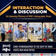
Hydrography is the branch of applied sciences which deals with the measurement and description of the physical features of oceans, seas, coastal areas, lakes and rivers, as well as with the prediction of their change over time, for the primary purpose of safety of navigation and in support of all other marine activities, including economic development, security and defence, scientific research, and environmental protection. Hydrographical measurements include the tidal, current and wave information. They also include bottom measurements, with particular emphasis on those marine geographical features that pose a hazard to navigation such as rocks, shoals, reefs and other features that obstruct ship passage. Bottom measurements also include collection of the nature of the bottom as it pertains to effective anchoring. Unlike oceanography, hydrography will include shore features, natural and manmade, lights and towers that will aid in fixing a ship's position, as well as the physical aspects of the sea and seabed. Hydrography of streams includes information on the stream bed, flows, water quality and surrounding land. Basin or interior hydrography pays special attention to rivers and potable water although if collected data is not for ship navigational uses, and is intended for scientific usage. The Navigation on River and Sea is done with the help of navigation chart and Hydrography is the science which provide all the required data for compilation of navigation charts. The Hydrography Department of IWAI is looking after the Hydrographic surveys and feasibility study/ DPR of 111 National Waterways. In modern world the hydrography is mostly dependent on latest technology for accuracy and timely completion of job. IWAI Hydrographic Department keeps abreast with latest technology by using latest equipment, the fortnightly bathymetric survey is conducted and Least Available Depth and River notification are published on IWAI website for safe navigation of mariner. Hydrographic Department maintains quality control and quality assurance of all hydrographic data received form field. Hydrographic Department also providing all necessary assistance for dredging operation, dredging volume calculation and channel designing, laying out of navigation buoys and River Information System. Hydrographic Department is also analyzing the shoal data for planning and preparation of scheme of River Training works.
Cartography
Cartography is a complex, an ever-changing field, but at the center of it is the map-making process. Viewed in the broadest sense, this process includes everything from the gathering, evaluation and processing of source data, through the intellectual and graphical design of the map, to the drawing and reproduction of the final document. As such, it is a unique mixture of science, art and technology. The IWAI cartography department has (a) Navigation Chart (b) River Navigation Atlas and (c) River Pilots of NW-1, NW-2, NW-3. and Sundarbans waterways. The Electronic Navigational Chart quite effective for the safety of Navigation and thus the preservation of the Earth's natural environment. The cartographic section is equipped with latest GIS and Charting Software's. In view of charting of 111 national waterway the Cartography Section is being upgraded with latest database solution and latest software for producing ENCs.

 भारतीय अंतर्देशीय जलमार्ग प्राधिकरण